|
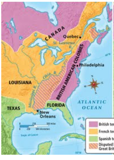
The French and Indian War in North America took place between 1754 and 1759.
|
TITLE:
Map of Colonial North America at the Start of the French and Indian War : 1754 Directions: Using the map to the left, recreate the information on the blank map provided. Pay special attention to river borders, and territories surrounding the Great Lakes Shade and label your map. Provide a similar color coded legend. Add TODAL(s) |
|
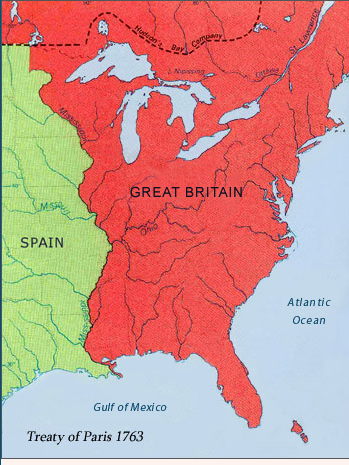
The last battle of the French and Indian War took place at Quebec City in 1759. The Treaty of Paris(1763) officially ended the war, and the map of North America was redrawn. Basically, the British received all lands east of the Mississippi River. (except for New Orleans) (Separate deals were struck with Spain to obtain Florida)
TITLE: Map of Colonial North America at the End of the French and Indian War : 1763 Directions: Using the map to the right, recreate the information on the blank map provided. Shade and label your map. Provide a similar color coded legend. Add TODAL(s) In 1763, the Treaty of Paris made the British Empire the largest empire in history.
BUT, the peace was not long lasting, as feelings of American Independence began to stir. |
|
