- Pioneers heading west encountered new landforms that made their progress challenging.
- This map standard asks you to create a POLITICAL and PHYSICAL FEATURES MAP of the UNITED STATES in 1845 from scratch. (freehand)
- Create (trace) an outline map of the United States on a blank sheet of legal paper. (DO NOT DRAW the borders of the states)
Part 1: PHYSICAL FEATURES: You will need to locate, draw and label major mountains, and important rivers and lakes.
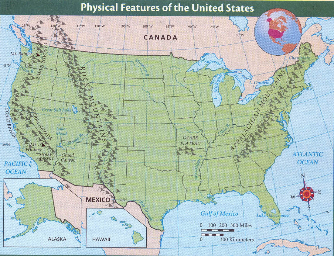
- Draw, label and color in blue: the five Great Lakes and the Great Salt Lake (See Map 2 below)
- Draw, label the Appalachian, Rocky, Cascade, Sierra Nevada, and Coast Mountain ranges. (See Map 2 below)
- Draw, label and color in blue: the Ohio River, the Mississippi River, and the Missouri River, (See Map 3 below)
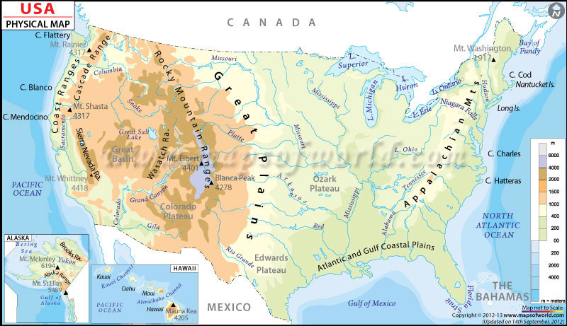
- Draw, label and color in yellow: the Great Plains (see Map 3 below) (you may want to create a grass symbol)
- Locate and label: St. Louis (at the confluence of the Missouri and Mississippi Rivers) (See Map 4 below)
- Locate and label: Salt Lake City, San Francisco, Oregon City
Remember to add TODAL(s), and include a legend / key for the symbols you have used.
Part 2 - an extra challenge for extra credit - see the instructions on the bottom of this post.
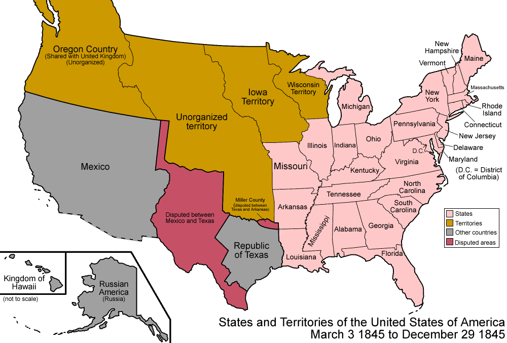
Part 2: Create an Overlay Map In 1845 much of the western United States was unorganized or claimed by Mexico, Great Britain, or part of the new country known as the Republic of Texas
POLITICAL FEATURES: This is tricky. Create an overlay map which you will layer on top of Part 1.
In 1845 there were 27 states. (Texas became the 28th state to join after Florida.) see the order of statehood here.
Draw and label and shade the Republic of Texas and Disputed Territory (see Map 1 above)
POLITICAL FEATURES: This is tricky. Create an overlay map which you will layer on top of Part 1.
In 1845 there were 27 states. (Texas became the 28th state to join after Florida.) see the order of statehood here.
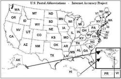
- Label the original outline map postal abbreviation of the 27 states that were part of the United States in 1845. (DO NOT INCLUDE TEXAS) (See Map 1 above) (DO NOT INCLUDE WEST VIRGINIA - it was not created until 1863)
- Carefully cut the map and place this overlay onto your larger map of the United States. Tape the map so that it creates a flap or leaf that can be lifted (opened or closed)
Draw and label and shade the Republic of Texas and Disputed Territory (see Map 1 above)
